")
Wales (United Kingdom)
The inter-tidal shipwrecks of Wales: Challenges and Opportunities
Dr. Julian Whitewright (Royal Commission on the Ancient and Historical Monuments of Wales, RCAHMW)
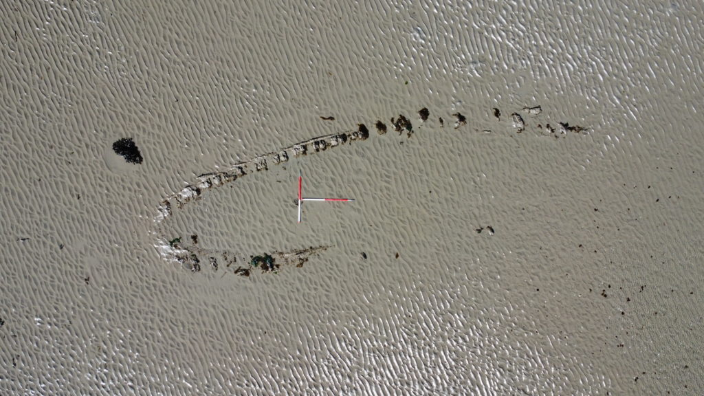
The inter-tidal zone of Wales is a diverse environment; from sandy beaches, to rocky shores, large expanses of sand or mud, and estuaries meandering far inland. Within this zone is an equally varied range of archaeological sites comprising material from prehistory, through to the present. Submerged prehistoric forest, fishtraps, harbours, crashed aircraft, lighthouses and of course shipwrecks, can all be readily identified.
The c. 150 shipwrecks within this maritime archaeological record are a challenging group of archaeological sites to manage. They are often buried in sand (or mud) with exposure taking place rapidly and often unexpectedly. Developing an understanding of the extent of the surviving archaeological remains can therefore be difficult and rely on chance exposure of material. This challenge is magnified when applied across the many inter-tidal shipwreck sites, coupled with the geographical range and environmental diversity within which they are placed.
Such challenges are worth overcoming. Wales’ inter-tidal shipwrecks span from at least the medieval period onwards, with demonstrable potential for much earlier material to be preserved. Individually, and collectively, they can greatly enhance our understanding of Wales’ maritime heritage, tell compelling stories of people and their seas, while also providing a material aspect to historical datasets.
Advances in technology are creating opportunities to further the knowledge, understanding and management of our inter-tidal shipwrecks. Previously inaccessible sites can be accessed for the first time using Unmanned Aerial Vehicles (UAVs), which also allow rapid repeat surveys. Techniques like photogrammetry have matured with standard methodologies available at an ever-decreasing cost, providing a sound archaeological method for rapid survey that is well-suited to the inter-tidal zone. Meanwhile, historical documents are increasingly becoming digitised, allowing more efficient background research and for the inter-relationships between different source types to be fully realised. Finally, our ability to leverage ‘citizen science’ through effective public engagement is providing a potential route for becoming better informed of site-exposure or major site formation change.
This paper therefore takes a country-wide, national view. The nature and scope of Wales’ inter-tidal shipwreck resource is explained. The challenges to surveying and managing these sites is outlined, including their place in Wales’ marine planning system. New opportunities, both technological, methodological and social, for how we can further our knowledge and understanding of these sites is then conveyed.
Top image: The wreck of the tugboat ‘Vernicos Barbara IV’ in a rocky cove near Solva, Pembrokeshire (RCAHMW).
1 thought on “Wales (United Kingdom)”
Comments are closed.
Hi Julian
Very impressed by your paper – do you have any papers or other online resources that could access about your work. I am looking for other examples of government agencies doing this work. We have a similar extensive intertidal resource here in NSW so am always interested in other approaches.
Great papwr
Brad Duncan